Dirt Devils Digest
August 2015
The Dirt Devils Digest
August 2015
A monthly publication of the Dirt Devils
Table of Contents
Presidents Message:
We are half way through the year but don’t get
discouraged there are still many trail activities available
Run reports
3
for the rest of the year. If interested in going to the North
10 reasons to be a trail leader:
3
Rim next year (that would be 2016) let me know we need
Trail Tools
3
to begin planning now.
Adopt a Trail
4
Bishop California:
4
Of course December is the run planning meeting for next
year.
Run Calendar
6
Adopt a Trail meeting place
6
We have many great methods of communicating now,
September
6
our newsletter, the web site dirtdevils.org, face book and
October
7
course you can still use the telephone. Check out the
November
8
forum, Chris has been working on. It is a great place to
December
8
New Member
8
We have a few new members, take time to get to know
August
8
them better.
July
8
See you on the trail.
Guests
8
Ray Kleinhuizen
Classified
8
Club info
9
Meeting Place
Club officers
Club membership
9
Accessories
Awards
Newsletter advertising
First aid kit tracking
10
Run report template:
10
Run announcement template
Day of the Run:
DD Trail Ratings
10
Adopt a Trail
11
Cowbells
12
What every future off roader needs
DD newsletter aug15.doc
pg 1 of 12
printed: 8/23/2015
Dirt Devils Digest
August 2015
Ham Radio update
Mike Wallace reporting. HAM report - Have a few new
The Marines have also developed a mobile app for Johnson Valley
HAM operators making the total 15. Will be scheduling
OHV Recreation Area to alert the user to the SUA temporary
another class for some time in January. There are
closures for military training and when the user approaches/crosses
additional opportunities outside of the club. Planning on
into an area permanently closed to public access. I've attached the
using the 2 meter band so when looking for a radio, that's
instructions for obtaining this free app.
the main band that needs to be considered. Working on
putting a topic on the form on HAM radios. • Thank
If you have questions regarding the August 1-30, 2016 temporary
everyone for not giving him a hard time last month when
closure of the Johnson Valley Shared Use Area, contact the
he had to run the meeting.
Marines at 760-830-3737; smbplmsjohnsonvalley@usmc.mil.
Ocotillo Wells SVRA action
Cal 4 Wheel
By John Stewart, Cal4Wheel
The California outdoor economy is responsible for:
June closed with the release of the Scoping Summary for
Consumer spending:
$85.4 billion
the Ocotillo Wells SVRA General Plan. The scoping
summary information provides a large volume of data to
California jobs
732,100
review. Next, the OHMVR Division and BLM will
Salaries and wages:
$27 billion
prepare the Preliminary Ocotillo Wells SVRA Plan. In
Local tax revenue
$6.7 billion
addition, a Draft EIR/EIS will be prepared that addresses
the potential environmental impacts of the Ocotillo Wells
SVRA Plan, proposed alternatives, and potential
Desert closures
mitigation measures. A public comment period will be
The OC Register and the LA Times are reporting.
held to solicit public comments on the Preliminary
Unbelievable when is enough, enough.
Ocotillo Wells SVRA Plan and the Draft EIR/EIS, before
Dianne Feinstein said she has asked President Obama to
a Final Ocotillo Wells SVRA Plan and Final EIR/ EIS is
bypass Congress and create three new national
approved. No dates for those document releases are
monuments in California, giving federal protection to
available.
more than 1 million acres of mountain ranges, sandy
expanses and forests lying roughly between Palm Springs
and the Nevada border.
The San Gabriel Mountains National Monument recently
closed down half of Angeles National Forest
Amy Granat, managing director of CORVA (California
Off-Road Vehicle Association), was disappointed with
Feinstein's action.
20150822-story.html
Johnson Valley closure
The Marine Corps recently notified BLM of their plans to utilize
In other Ocotillo Wells news, the SVRA is continuing
the Johnson Valley Shared Use Area for military training from
implementation of the California Fish and Game
August 1-30, 2016, and of the associated temporary closure. BLM
Commission acceptance of a petition to list the Flat-tailed
is working with the Marines to address issues associated with this
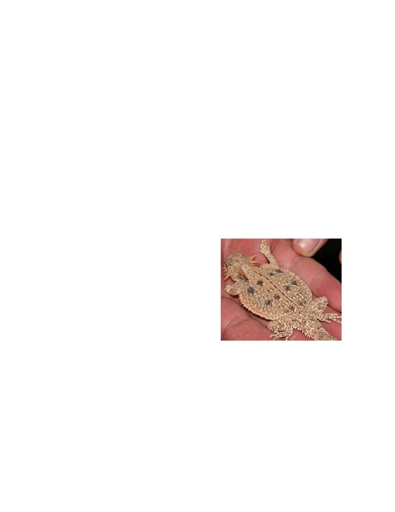
Horned Lizard on the California Endangered Species list.
military training/closure, and to keep the public informed.
The immediate impact is that no permits for events in
Ocotillo Wells SVRA will be issued during the one-year
BACKGROUND: On December 26, 2013 the National Defense
temporary listing period.
Authorization Act of 2014 (NDAA) was signed into law,
To review information on the flat-tailed horned lizard,
authorizing the Marine Corps to occupy the Johnson Valley Shared
visit the following links:
Use Area (SUA) for two 30-day periods annually during which
time the area would be closed to the public. See attached Johnson
Horned-Lizard-Copy
Valley Subregion map.
The Marines have established a project website to obtain additional
While the immediate impact is within state managed
information. The project website is
public lands, a formal listing will have repercussions on
other lands within the defined critical habitat area -
ohnsonValley.aspx
basically, Imperial County.
DD newsletter aug15.doc
pg 2 of 12
printed: 8/23/2015
Dirt Devils Digest
August 2015
State Parks (OHMVR Division) is working to implement
Mountain. • New forum section on land use issues (please
a “take permit” process so that events can be permitted
get involved). • Will add a forum for HAM radios and
with certain conditions applied. Park officials believe they
thinking about adding one for camping. Let Chris know
have sufficient valid data to justify that past activities
other ideas for the forum. Suggestion to add reviews.
have not harmed the FTHL.
For Cal4Wheel, that means Operation Desert Fun cannot
Trail Tools
be held as in past years. Arrangements have been made to
We all know it’s important to carry tools in case
relocate event headquarters and staging to the Blu Inn
something breaks when we are on the trail. We also know
RV Park, which is private property adjacent to the SVRA.
that spare parts can be the difference between walking
Scheduled runs will be directed towards Superstition
and driving off the trail. The question is: will we be able
Mountains OHV area, which is under BLM management.
to perform a trail fix that’s not straight forward? These are
Online registration is now open! Only $25 if you
important issues we all should think about before each
register by August 31. Info | Registration
run. The fact is, if you 4-wheel, on any level of difficulty
trail, sooner or later you will be faced with a trail fix
situation! Close scrutiny above and below your rig will
Web site info
reduce the likelihood. Loose screws, nuts and bolts.
Unique visitors are down, slightly. California visitors
But what tools and spare parts should we bring? Most of
down, but US visitors are up. Hackers down 5% from last
us have limited space for tools and spare parts in our rigs.
month, 3% under average Search engines up significantly
Therefore we bring tools and spare parts that we hope will
with Google leading, as usual. Referrals to club steady
fix whatever breaks so that we can be back on the trail in
with Quadratec continuing to be the highest other referrals
minimal time. Knowledge of your vehicle is very
(typically spam) up from average. Two new forum
important when selecting tools and spare parts. It’s a good
members plus one duplicate Added forums: CB and Ham
idea, if possible to pack a separate tool kit specifically for
Radios, Camping Tips, Tech Tips and Tricks.
your 4 wheeling vehicle. A good way to determine if you
have the right tools in your kit is to do some basic
Run reports
maintenance on the vehicle using only tools from your
take along tool kit. This will give you a good idea of how
10 reasons to be a
much you can accomplish with that tool kit and what
trail leader:
items need to be added.
10 - You pick the trail (hopefully someone will want to
A sample list of items in a trail tool kit is identified
run it with you)
below. Your knowledge of your vehicle should help you
9 - You pick the run start time and meet spot
edit the list to include the tools and spare parts that could
8 - You write the run announcement
be needed on the trail. No matter how prepared you are, a
failure can still ruin your day because it’s not practical or
7 - You pick the CB channel (duh 4)
possible to carry every spare part that might be needed.
6 - You conduct the drivers meeting (best if done before
you start the trail)
Recommended trail tools:
5 - You carry the Dirt Devils club first aid kit (hopefully
1. Socket Set (some vehicles use both standard &
you know how to use it)
metric), ratchet and extensions
4 - You pick the bathroom stops (more stops keep you
2. Combination wrenches (some vehicles use both
out trouble)
standard & metric)
3 - You are the spotter when someone needs help (you’ll
3. Vise grips
get a lot of exercise)
4. Adjustable jaw pliers and channel locks
2 - You will get unwavering support from all drivers even
5. Crescent Wrench
when you are hopelessly lost and confused.
6. Spark plug wrench
1 - You get to ride in front of everyone out of the dust
7. Screwdrivers (Standard & Philips )
(this the only good reason to be a trail lead)
8. Hammer 9. Bottle Jack
10. Utility Knife
Web site info Chris Slaughter web site manager
11. Hacksaw
Running good. May and June both had over 1,000 unique
12. Latex Gloves
visitors. One of the guests found this club through a
13. Tire plug kit
referral from another site. A couple googled the site. A
14. Hacksaw
couple got business cards. Have 36 members signed up.
15. Rags
• Added trail tracks for around Bishop and White
16. Funnel
DD newsletter aug15.doc
pg 3 of 12
printed: 8/23/2015
Dirt Devils Digest
August 2015
17. Flashlight / work light (extra batteries)
a backhoe but right now it is allocated to the fires. I might
18. Ratchet straps
add that Mike is a great cook.
19. Cordless tools (impact driver, saw, etc.)
Bishop California:
Spare parts and consumables:
Silver/Wyman Canyon and Coyote Flats
The extreme situations: carry no spare parts, or carry so
July 11 & 12, 2015
many your rig breaks due to the extra weight. What you
need to do is get somewhere in the middle by carrying
Club Members:
parts that are most likely to fix your broken rig. If you
1.
Ray and Karen Kleinhuizen
have knowledge of your vehicle, any special items can be
2.
Pete Johnson
added. If your rig has a history of U joint issues carry a
3.
Chris Slaughter
spare.
4.
Danny Delp and fiancée Kim
5.
Chris and Alison Johnson
Sample Spare parts list: add or subtract as needed!
6.
Scott Beggins
1. Fuses, electrical wire, electrical tape, duct tape,
7.
Rod and Carrol Abbott
nylon wire ties, silicon sealer
8.
Steve and Mary Hendry
2. Miscellaneous nuts, bolts and hardware
9.
Jack and Zoey Pacela
3. Fan belts, hose, clamps
Guests:
4. Valve stems, tire plugs
1.
David and Susan Hawkinson
5. Engine oil, brake fluid, transmission fluid, etc.
2.
Debi Craddock and husband Joe
6. Coolant or water for the radiator
Bishop California is located in the Owens Valley west of
the White Mountains and east of the Sierra Nevada
Once you have everything together, you need to
Mountains. There are several trails around Bishop. Most
determine how to store them in your vehicle. A
are easy but some have moderate to difficult sections. The
permanently installed tool box or a carry-on tool bag / box
plan was to do two day runs: an easy run on Saturday and
that can be secured to the vehicle are good choices.
a more difficult run on Sunday. The Saturday run was
A breakdown will likely include crawling under the
Silver and Wyman canyons in the White Mountains with
vehicle and messy parts. Bring a blanket, towel or plastic
a lunch stop at the ancient Bristle Cone pine forest. The
trash bag that you can lay on. They also help keep parts
Sunday run was to Coyote Flats, a high valley at 10,000
and tools away from the dirt.
ft. elevation in the Sierra Nevada Mountains. The club has
tried this trail before and had to turn back at the hard
Many breakdowns can be fixed on the trail with some
spots. The plan this time was to only bring well equipped
tools, spare parts and knowledge of the vehicle. Keep an
rigs and go in from Big Pine to do the hard sections early
open mind when the fix is not straight forward. Many
in the day.
vehicles have been driven off the trail with unique fixes.
A ratchet strap can be used to keep an axle in place to
Six vehicles caravanned to Bishop on Friday. We made a
stop at Manzaner a Japanese detention camp during world
drive off the trail. (I have personal experience) A high lift
jack handle and hose clamps can straighten and splint a
war two. We drove through several rain showers between
bent tie rod.
Lone pine and Bishop. This raised the concern of rain
over the weekend but the weather was never an issue.
With some forethought and preparation you should be
Temperatures were a little cool at the higher elevations
able to deal with a wide range of common trail fixes. The
but overall mild otherwise.
big plan here is to safely get you off the trail after a
breakdown.
Saturday July 11:
Adopt a Trail
We had 11 vehicles meet in the Brown’s Town CG
parking lot. The first issue was Chris had some bad noise
July 25th 2015
coming from his axle. Chris diagnosed the issue to be a
Current hours - 221.00
problem in the rear dif. and rode with Scott Beggins. The
remaining 10 vehicles headed out to Silver Canyon road,
Maintenance plan complete
a dirt road that goes straight to the base of the White
Mountain range. The trail then winds its way into Silver
Six vehicles on Friday night. Roger and 5 more vehicles
came out Saturday morning for a total of 11 vehicles on
canyon going through several water crossings along the
way. The canyon starts to get narrow as the steep climb
Saturday. We worked on the bypass and moved alot of
rocks. Moved a tree and trimmed another. Still alot of
starts. The trail becomes very steep with many tight
switch backs all the way to the top at 10k ft. elevation. At
work to be done. We have asked the Forest Service to get
the top is a very good view of the Sierra Nevada
DD newsletter aug15.doc
pg 4 of 12
printed: 8/23/2015
Dirt Devils Digest
August 2015
Mountains to the west. Rod was running hot and needed
quite a bit of water. The problem was a bad radiator cap.
Sunday July 12:
Rod and Carrol were able to finish the Saturday run.
We had seven rigs for the Sunday run. Scott was out,
steering/front axle issues. Jack and Zoey were out, their
camp site was inundated with rain and water, Jack was
sick and the Jeep had issues. Rod and Carrol were
planning to go home Sunday. Chris Slaughter parked and
rode with Steve.
We headed to Big Pine then turned west to the Sierra
foothills. There was some unknowns about the difficulty
of the trail and the best way to take. GPS, Google earth
and good maps helped with trail finding.
We decided to head over to the Patriarch Grove, a high
elevation (11.2k ft.) grove of ancient Bristle Cone pine
trees. This grove is named after the Patriarch tree, one of
the largest known Bristle Cone pine trees. We ate lunch
here taking in the history and beauty of the area.
After lunch we headed to Wyman canyon for our slow
decent out of the White Mountains. Along the way we
had stops at a miner’s cabin, a small ranch and a small
water fall. A group of students from Deep Springs
College were staying at the small cabin near Wyman
The trail headed almost straight up with great views of the
spring. The students were caring for the cattle grazing in
Owens Valley and glaciers in the Sierra Mountains. After
the canyon.
a few miles of steep climbing we came to a rocky section
that started downhill. I saw a vehicle near the bottom of
the trail. He saw us coming down and seemed to be
waiting to let us pass. We get down to him to find out he
had moved his Jeep Cherokee over to let us by and was
stuck in the soft dirt on the down side of the trail.
We passed a BLM sign welcoming us to BLM land just
before the road ended, say what! We actually were on the
right road but it was over grown with thick brush that had
expanded out of Wyman creek. We had to back track to
First I had to get past him to try and pull him out. Then
the last turn to find the way out. This is a common
we attempted to use a strap to pull him back on the trail.
problem in the White Mountains. The trails don’t get
As soon as he starts moving he slides another foot down
heavy use and the brush, trees or both grow or fall on the
the hill. We tried letting him maneuver on his own but he
trail. The trails are closing themselves due to lack of use.
just got in deeper. We finally decided to put a strap
Saturday ended with a 52 mile drive on black top back to
around a rock. Attach a winch line through a snatch block
Bishop going back through the Westguard Pass. We had a
to Cherokees rear driver side. This created the angle
group dinner at the pizza place in town.
needed to slide his rear end over until firmly on the trail.
DD newsletter aug15.doc
pg 5 of 12
printed: 8/23/2015
Dirt Devils Digest
August 2015
He was then able to back onto the trail and get turned
Run Calendar
around.
Adopt a Trail meeting place
8:30am at Rocky’s Roadhouse
32150 Hilltop Blvd Running Springs, CA 92382
next to the 76 gas station
September
1st club meeting
4th -
7th High Sierra Poker Run CAL4WD event.
near Shaver Lake
11th - 13th Sherman Pass -
Monache Meadow
Run Date: Sept. 12, 2015
Trail Leader: Danny Ward
I soon found out that while we were working on the
(Cell 714-651-9717) d4lward@sbcglobal.net
Cherokee David Hawkinson got too close to edge a few
Meeting Location: Troy Meadow Campground Entry
feet behind and needed a winch to get back on the trail
himself. Lesson learned: on this trail If you get too close
Meeting Time: 7:45 am - Leaving at 8:00 am.
to the edge, you are either stuck, sliding down the side of
Directions to Pearsonville, Ca.: Starting at CA-91 east
the hill, or rolling over. None of these are good options.
bound toward the I-15, take I-15 north toward Barstow
A sign post in the hard section marks the spot of a roll
43.3 miles. Take exit 141 to merge onto US-395 north
over in 2006.
toward Bishop/Adelanto 98.3 miles. Take the ramp onto
US- 395 north 7.3 miles to Pearsonville, Ca.
Special Note: Pearsonville, CA. is the last chance for
Gas. Pearsonville elevation is 2513 and going to Troy
Meadow elevation of 7800 is a little bit of a climb.
Directions to Troy Meadow Campground: From
Pearsonville take US Rt. 395 north 2.6 miles to Kennedy
Meadow sign. Turn left at sign onto Nine-mile Canyon
Road and go 24.6 miles to a “Y” intersection. Bear left
onto Sherman Pass Road and go 10.3 miles to
campground sign. Turn right at sign into campground.
Special Equipment Required: Minimum 31” tires but
could have trouble. High ground clearance vehicle
required and rear lockers.
A little way up the trail from the rocky spot we saw a
Trails Description: Sherman Pass 4 wheel drive road is
warning sign that classified the trail as Most Difficult.
narrow, rocky, and steep. Road is difficult terrain, expert
After passing the warning sign we turn southwest around
4WD techniques required. Not suitable for long wheel
Sugarloaf Peak into Coyote Flats. We had lunch at a nice
base vehicles. (6.8 miles)
camp site at the edge of the trees. Three deer were grazing
Permits: "Forest Adventure Pass" is needed to park
in the trees behind us. After our late lunch we headed
along this trail.
through Coyote Flats, down into the back of Bishop. We
Reminder to Bring: Camera, Warm Clothing, Chair,
met at the bowling alley that night for dinner, drinks and
Lunches, etc.
talk about the day’s events.
Weekend Plan: I’m leaving Friday the 11th and tent
David Hawkinson is not a member and Jeff (the guy in
camping Friday and Saturday nights at Troy Meadow
the Cherokee) is not a member, therefore no cow bells.
Campground.
Another great run with a fun group of people.
19th Adopt A Trail - Josh
Last Saturday of September Adopt a Trail BBQ
19th & 21th Sand Sport Show Costa Mesa Fair Grounds
DD newsletter aug15.doc
pg 6 of 12
printed: 8/23/2015
Dirt Devils Digest
August 2015
19th & 20th KOPL
Body damage and breakage are possible. Elevation ranges
Kids on Public Lands We always need female drivers on
from 5600' to over 6500'. Wet tires add to the difficulty
Sunday.
as the trail crosses Holcomb Creek in a few areas.
Difficulty:
(1=Easy, 5=Most Difficult) Rated 5, due to
the last 2 boulder fields (i.e. most of the trail is easy).
There is a bypass route around these rock gardens but it's
a separate trail (2N06X). The rest of the trail is rated 1
with a couple of 3 rated obstacles.
CB Channel: 4
Special Equipment Required: High ground clearance
with limited slip or lockers, 33 inch tires or larger
recommended but not required. We have seen stock jeeps
make it with some damage. Tire damage is always a
possibility. A good spare is required.
Bring: Bring lunch and extra water, chairs, basic tools,
shovel, camera, extra weather appropriate clothing, etc.
Weather: If it’s raining the trip will be canceled.
Holcomb Creek 3N93, Big Bear
Trail Head Coordinates:
Saturday Sept 26th
Start: 3N14 is N34° 18.027 W116° 58.940
Trail Organizer: Jack & Zoe
Finish: 3N16 is N34° 16.521 W117° 03.049
Departure: We will join up to 3N16 at Crab Flats and
head towards Green Valley/Running Springs at
Highway 18.
October
2nd Wrightwood Willys-Jeep Day
Short cut:
sqmeffvse2sml76httn641p90o_201510031600
3th & 4th Off Road Expo Pomona
6th club meeting
6th Monthly club meeting
RSVP: Yes, Cell 909-213-6787 or Email:
9 - 11th Fun in the Desert
sqca12@verizon.net
sponsored by Victor Valley 4 Wheelers & Cal 4 Wheel
Trail Leader camping: No, day trip only.
Means Dry Lake Johnson Valley, CA
Permits Required: Yes, Adventure Pass. Annual $30 or
16- 17 Operation Desert Fun
day $5, available at most grocery/gas stations, as well as
Ranger stations and Discovery Center
Meeting Time: 8:30am. Go over rig readiness and plan,
leave at 9am.
Meeting Location: Rocky's Roadhouse
(32150 Hilltop Blvd, Running Springs, CA 92382) i.e.
usual spot across from 76 gas station. From there, we will
drive to Big Bear (north shore) Fawnskin area to 3N14 to
Coxey Road.
Trail Description: 3N93 is a 6 mile trail. You can
expect to encounter large boulders, tippy terrain and
puddles and moguls on sections of the trail. The US
Forest Service rates this trail a Black Diamond Most
Online registration is now open! Only $25 if you
Difficult trail and it is not recommended for stock SUVs.
DD newsletter aug15.doc
pg 7 of 12
printed: 8/23/2015
Dirt Devils Digest
August 2015
register by August 31.
4.
Mark & Kaylynn- 15 JK
5.
Rudy Quinoz - 15 Tacoma
17th Miller Jeep Trail (M) - Pete
6.
Clayton Walz - Rubicon
24th Adopt A Trail - Lead TBD
7.
Suhag Patel - 97 Landcruiser. •
8.
Paul Zuliani - 12 Wrangler Rubicon •
November
9.
Mark Suarez - 14 Rubicon •
3rd Monthly club meeting / run planning 2016
10. Eric Dow - 15 JK •
6th - Black Canyon (E) - Ray
11. Mike McCarty - 12 Unlimited •
12th - 14th Panamint Valley Days (PVD), Cal 4 Wheel
event
Classified
We're celebrating 30 years of having fun in the Panamints
with all your friends and family; all those great sunrises
New Complete Dana 30 axles shafts a little rust.
and sunsets. All those flyovers, the rain, the snow, and W,
keep a spare with you at all times, just in case
the great starfield at night, really seeing the Milky Way.
was in my 2000 TJ (until I upgraded) should fit ’97 - 2006
All this makes Panamint Valley Days so fun and great to
maybe others that I don’t know about.
spend time with all your friends and family.
For full info and resistration:
days?utm_source=CA4WDA+Updates&utm_campaign=
04e69c8669-barrett-lake-reopen-07-27-
15&utm_medium=email&utm_term=0_d30f6c948f-
$50. Each, driver and passenger side.
04e69c8669-
contact Ron Webber 714 715 5692 or ronjp@outlook.com
85608049&mc_cid=04e69c8669&mc_eid=e64d42a631
Alternator from 2000 TJ stock swapped out for one with
higher amperage at about 40k miles
December
1st Monthly club meeting
5th Calico Run Leader Ron Webber
New Member
August
1.
Jack Sobelman - 15 JK went on Corral Canyon
and Cleghorn •
2.
Karen Hykuis & James Leamon - 66 Scout.
Karen & James are also members of the
Roughwheelers they ran 3 runs at HDR and
helped with the HDR registration desk.
Free contact Ron Webber 714 715 5692 or
ronjp@outlook.com
3.
Janet Johansen- 15 JKU went on Black Canyon in
February, Cleghorn and two runs at HDR.
4.
Debi Craddock - 12 JK two runs at Bishop
July
Dave Mauer
Eric Walberg
Guests
1.
Steve Murphy - just bought his Jeep three weeks
ago, 02 Wrangler
2.
Jerry & Dana Horner - yellow and black 06 LJ
3.
Andrea Friedenthal - 96 XJ
DD newsletter aug15.doc
pg 8 of 12
printed: 8/23/2015
Dirt Devils Digest
August 2015
Oil pan John Bull trail tested.
President: Ray Kleinhuizen
kkfusedglass@roadrunner.com
Immediate past president:
Jesse May: jemay.xj@gmail.com
Vice President: Mike Wallace proudpop80@gmail.com
Secretary: Cheryl May: jemay.xj@gmail.com
Treasurer: Emi Webber: emiwebber@hotmail.com
Web Master: Chris Slaughter:
webmaster@dirtdevils.org
Adopt a trail chairmans:
Roy Chance: rchance@aol.com
Roger Mauer: rogermauer@gmail.com
Free contact Ron Webber 714 715 5692 or
Newsletter: Ron Webber: ronjp@outlook.com
ronjp@outlook.com
Hospitality: Emi Webber: emiwebber@hotmail.com
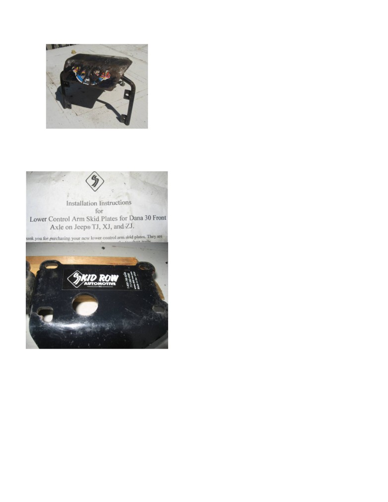
Control arm skid plates bolt no welding needed
Safety Committee: Bill Smith:
arm-skid-plates.html new never installed
Run Coordinator: Rick Walter rick03tj@gmail.com
Emergency response team coordinator: Rick Walter
rick03tj@gmail.com
the emergency response team makes themselves
available to help with our adopt a trail Dish Pan.
CAL4 wheel reps: Jesse May and Keith Graham
Club membership
Membership dues:
Dirt Devil annual club dues
$36.00
Spouse
$12.00
CAL4WD annual dues
$45.00
CAL4WD permanent member
$675.00
CAL4WD permanent member 12 installments of ... $56.25
CORVA
$30.00
Accessories
Available at the regular meetings, see Emi Webber.
Dirt Devil Stickers: $15.00.
Short sleeve shirts: $15.00
Long sleeve shirts: $18.00
$50 contact Ron Webber 714 715 5692 or
Sweatshirts: $30.00
ronjp@outlook.com
Hats: $20.00
DD logo magnets available in various sizes for
Club info
$4.50 to $13.50 each.
Meeting Place
First Tuesday of each month,
6:30pm for Dinner & 7:30pm for the meeting at
just east of Imperial Hwy and north of the 91 Fwy.
Marie Callenders. 5711 East La Palma Ave., Anaheim,
CA 92807, 714-779-0600
Club officers
DD newsletter aug15.doc
pg 9 of 12
printed: 8/23/2015
Dirt Devils Digest
August 2015
Participants:
Awards
Members:
Guest:
The story:
Weather:
Cow bells earned:
Run announcement template
Research and/or Pre-run the trail route.
Create and Post a Run Announcement
When emailing the run announcement: Please, use the
words “Run Announcement” in the Subject line of the
message, forward to the webmaster and newsletter editor.
Date/Time and Place for the Run
Description of Run
CAL 4 Wheel Drive, new member award
Difficulty Rating
Run Type: Base Camp, Day Run
Newsletter advertising
Directions to Meeting Place.
$25 for ¼ page ad, for 3 issues
EXACT Departure Time from Meeting Place
$50 for a ½ page ad, for 3 issues
Required Equipment. Open dif ? Lockers?
$100 for a full page ad, for 3 issues.
Is RSVP Required?
A full page ad also gets a Web Link.
CB Channel channel 4, if to much traffic then switch to 5
and so on.
First aid kit tracking
HAMM channel 146.440
FA #1 (red, blue backpack)
Camping Location/ Directions/ Details/ Facilities/ Fees.
Ray Kleinhuizen
Access for motor homes?
Mike Wallace
Contact Information (Run Leader
Phone Number & email address)
Josh Bleijenberg
Ron Webber November 2014
Ray Kleinhuizen July 2014
Day of the Run:
FA #2 (Orange canvas bag)
Hold brief driver’s gathering before start of run. Include
Mike Wallace
special instructions.
Josh Bleijenberg
Assign vehicle order if there are vehicles with open diffs.
Have vehicle with locked diff in front & behind. (If
Pete Johnson
possible disperse vehicles with HAM radios near the
Josh Bleijenberg corral cyn then handing off to Pete
front, middle and rear of the line.
Ray Kleinhuizen
Encourage drivers to learn the name of the person in front
Danny Ward
and behind his/her vehicle.
Josh Bleijenberg April 2014
Assign Tail Gunner Vehicle
Roger Mauer Feb 2014
After returning home forward to the newsletter editor a
FA #3 (Orange canvas bag)
Run Report and a few photos. subject line write
Roger Mauer
“Run Report”
Danny Ward
Ron Webber March 2015 Calico
DD Trail Ratings
Rick Walters July 2014
Pete Johnson April 2014
Trail ratings are subjective and weather conditions over
Ron Webber March 2014 Calico
the years can change a trail. An easy trail can become
more difficult after or during rain. The trail leader needs
to be the final judge of trail conditions the day of the run.
Run report template:
If any part of a trail is difficult the trail is rated difficult. If
Run name:
difficult sections have bypasses the trail may be suitable
Run leader:
for less capable rigs or less experienced drivers.
Date:
E - Easy (Black Canyon, Mohave Trail)
Number of rigs:
DD newsletter aug15.doc
pg 10 of 12
printed: 8/23/2015
Dirt Devils Digest
August 2015
M - Moderate (Devils Loop, Miller Jeep Trail)
N34° 16.106 W117° 07.745.
D - Difficult (John Bull, Calico)
The East entrance:
3N16 is N34° 15.663 W117° 05.116.
(E) Easy trails could include these conditions:
Meeting place
• Any dirt, sand or gravel road.
8:30am at Rock Road House
• Gentle to mildly steeper hill climbs, mild rocky
32150 Hilltop Blvd Running Springs, CA 92382 next to
sections and/or soft sandy sections.
the 76 gas station
• Four wheel drive may not be necessary all the time.
Adopt a trail Current hours - 192
• Pot holes or ruts that require high ground clearance.
• Water crossings are up to 15 inches deep.
• Suitable for full size vehicles.
• Low gears may be required on hill climbs.
• Recommend 4 wheel drive vehicle
• Suitable for most tire sizes
•
(M) Moderate trails could include these
conditions::
• Steep rutted and rocky hill climbs that require careful
tire placement.
• Two to three foot ledges to climb and/or steep down
hill drop offs.
• Rocky sections that can cause body or rim damage.
• Water crossings might have rocks and could be
deeper then 12 inches.
• Brush or cactus may touch vehicle.
• These trails will require low range gears, high ground
clearance and 4WD.
• Skid plates and body protection are recommended.
• Minimum 33 inch or bigger tires.
• Recommend at least one axle locker.
(D) Difficult trails could include these conditions:
• Rocks as big as your tire to as big as your vehicle.
• Hill climbs are steep and may require extended wheel
travel.
• These trails can have long sections of large rocks that
require careful tire placement. .
• Three + foot ledges to climb and steep drop offs.
• Body damage is possible and brush may scratch
vehicle.
• These trails will require vehicle modifications such as
suspension lifts, body protection and skid plates.
• Minimum 35 inch or bigger tires.
• Recommend front and rear axle lockers.
Adopt a Trail
The Dirt Devils Adopt A Trail is: Dishpan Springs Trail
(3N34)
Dishpan Springs Trail can be found in the
San Bernardino National Forest near Lake Arrowhead.
The Dishpan Springs Trail is one of the toughest and most
popular trails in the SBNF.
The West entrance:
2N26Y is N34° 16.198 W117° 08.258.
The T6 Bridge:
DD newsletter aug15.doc
pg 11 of 12
printed: 8/23/2015
Dirt Devils Digest
August 2015
Cowbells
Little Blue bell
Bill Smith HDR May25 2015 winched Bronco on to trailer
Gilbert at Corral Canyon 4/10/15
Chris Slaughter Grizzly
The cow bell rules are: If you get stuck and are unable to
Rick Walter
move under your own power and need the help of a winch
Mike Wallace
or you get strapped from one of your fellow jeepers then
you have earned the privilege of hanging a cow bell from
your front bumper. You must leave the cow bell on the
front of your rig until another Dirt Devil gets stuck then,
you can proudly hand it over. This starts at the beginning
and the end of the trail, not on the highway.
Mike Maneth memorial bell
Frank Gilliland John Bull 6/27/2015
Mike Wallace Corral Canyon 4/10/15
James Eddinger Claw Hammer 1/10/15.
Castulo Olivas
Old logo green bell
Josh Bleijenberg Corral Canyon 4/10/15
Josh Bleijenberg Dusy Ersham Sept 2014
Brown bell
Bill Smith HDR May25 2015
Tim Debolt Rattlesnake Feb 2015
Rick Walter adopt a trail 6/27/2014
Josh Bleijenberg Corral Canyon 5/4/2014
DD newsletter aug15.doc
pg 12 of 12
printed: 8/23/2015